The objective of this exposition is to highlight the archeologic activities led by some teachers or researchers and engineer in the University of Picardie Jules Verne (Amiens, France) from 1969 to 2019. It will present some projects carried out in France and abroad.
Organising committee
Poster design and collaboration
Pauline Augé, Jean-Louis Cadoux, Julie Colaye, Michela Costanzi, Lucie Degroisilles, Gerard Fercoq du Leslay, Richard Jonvel, Vincent Legros, Sandrine Mouny, Sara Nardi Combescure, Maia Pomadère, Gilles Prilaux, Isabelle Queyrat, Philippe Racinet.
Poster graphics
Mégane Vialle
Credits
University of Picardie Jules Verne
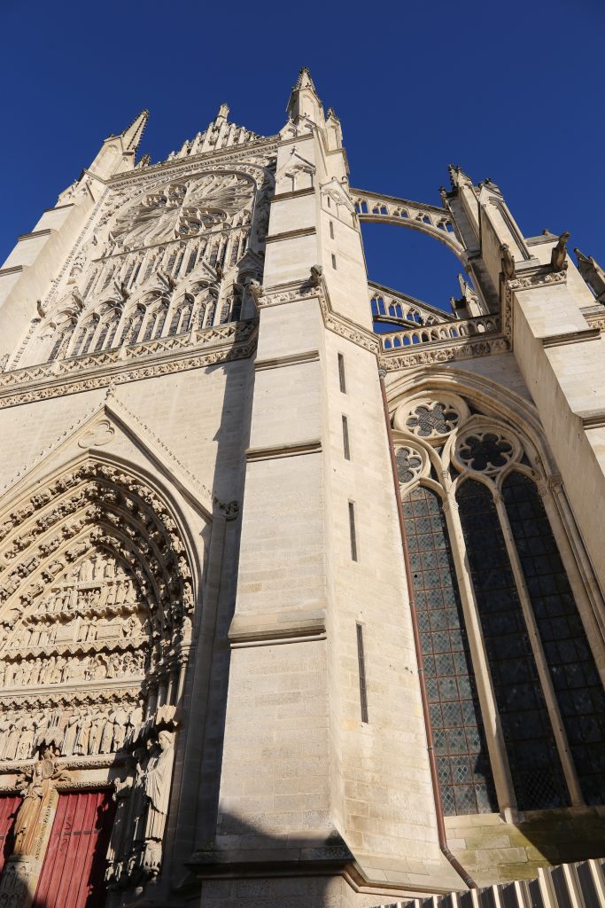
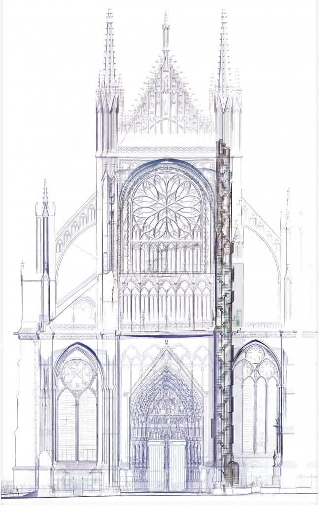
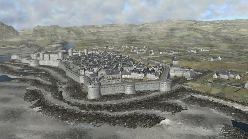
The transept studies on the Cathedral of Amiens has started in 2016. This project consists into the comparison of historic sources and virtual images of the cathedral building. The scanner to create the virtual images have enable the renewal of the knowledge of this part of the building. It allowed the searchers to sharpen its chronology and to understand to techniques used by the builders of the Middle Age to deal with the constraints of a such huge cathedral.
For the study of the transept, the survey techniques were adapted to the accessibility of the areas (photogrammetry, lasergrammetry or stone-by-stone surveying). Then, it building was modelized to highlight the imperceptible deformations. The project’s goal is to preserve, protect and enhance this monument. The data collected during this project could, in the future, guide restoration techniques.
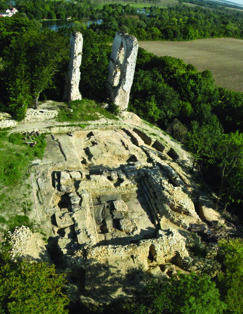
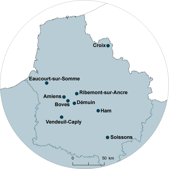
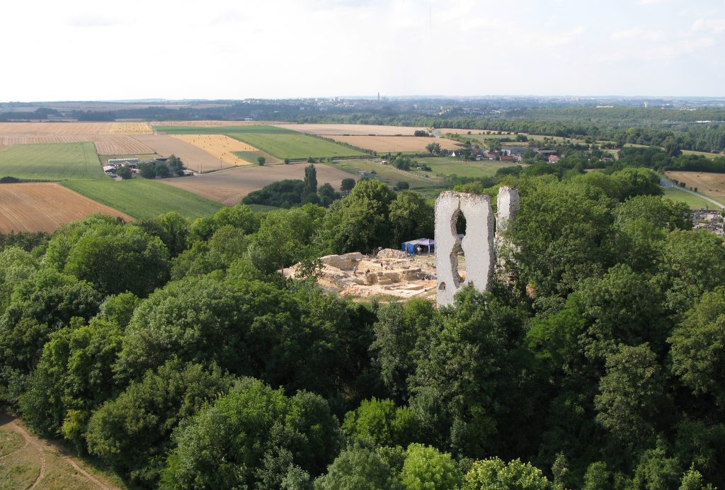
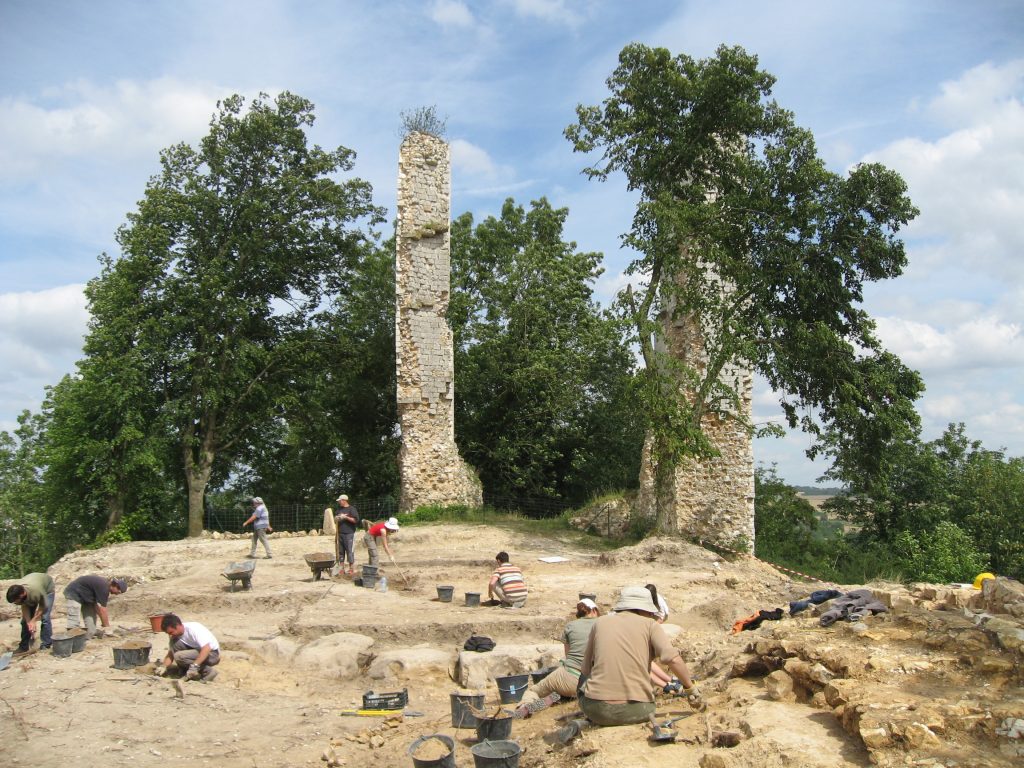
Located in the Somme, in the south of Amiens, the fortress of Boves is built on a promontory and crossed by gap. This castle erected on imposing mount has a strategic goal: watch and control the city of Amiens. It was fortified during the Carolingian era and presents 5 successive residences until its dismantling at the end of the 16th century.
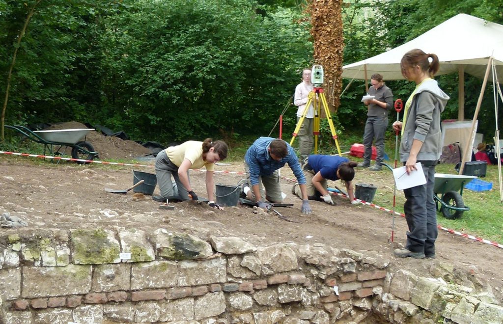
The researches were carried out from 1996 to 2016. It is also a site which has trained around 500 students. Those excavations have enabled the searchers to define the organization of the occupation and to study the diverse material forms of an aristocratic residence throughout the centuries. However, on the historic perspective, the work was quite tough because of the quantity of the sources available and of their dispersion. Nevertheless, the history of the Lords of Boves (10th-13th century) was studied by O. Leblanc in a thesis. A lot of objects (sometimes quite atypical) and furniture were discovered, they witness of the dense occupation of the site and the wealth of the inhabitants.
As the Church was being renovated, it was also excavated. It enabled the searchers to observe 4 successive churches, a medieval building and then, 3 others during the 19th century.
Several sepultures were discovered they mostly dated back from the end of the 14th century to the beginning of the 19th.
The UPJV has realized in 2012, a preventive excavation in Démuin, in Somme within the construction of a housing estate. The excavations have revealed many occupations of this place during the Medieval, Modern and Contemporary eras.
The first occupation had an agricultural and artisanal goal and dates back from the 9th to the 11th century. In the 12th century, the archeologists could observe a significant organization shift. This place had become an outer courtyard in link with the castle inhabited by the Lords of Démuin. Between the end of the 13th century and the beginning of the 15th, the outer court yard is burnt to the ground and a new residence was built. The earliest occupation stages were strongly impacted by the destructions of the First World War, indeed the village of Démuin has been touch by the bombs and destroyed like its church.
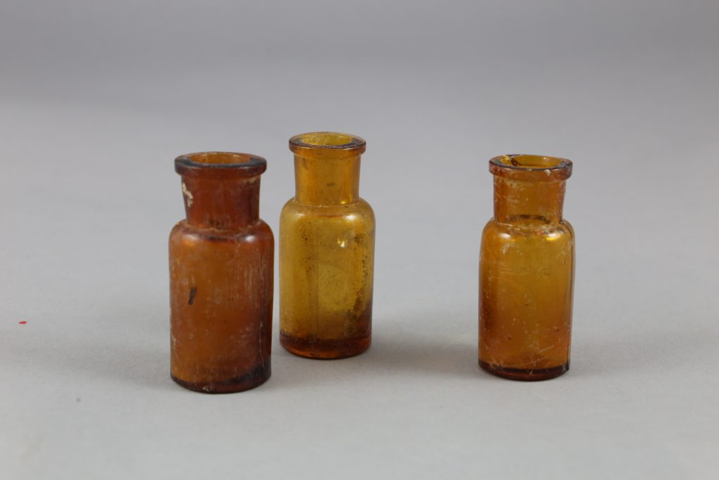
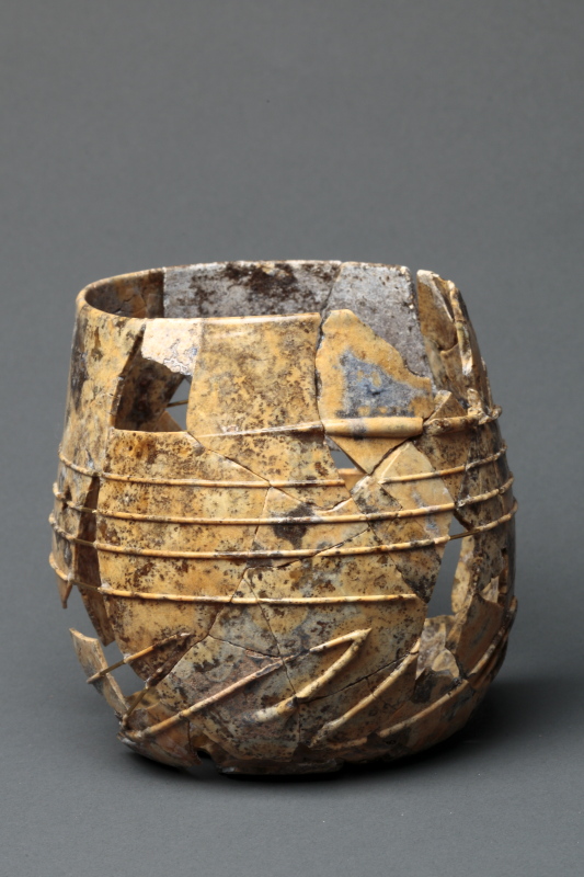
In Démuin, the archeological furniture is diverse, in a great quantity and globally, in a good state of conservation, some pieces of this collection are in ceramics and other in metal. Some coins were also found as well as some objects carved into bones.
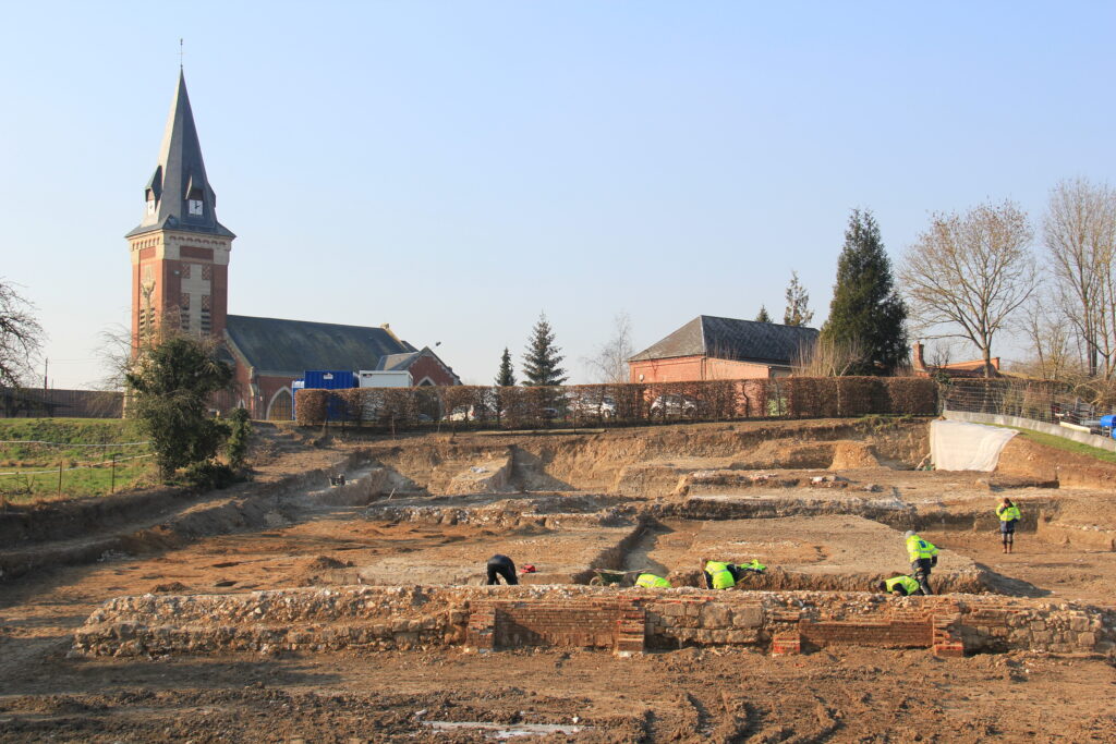
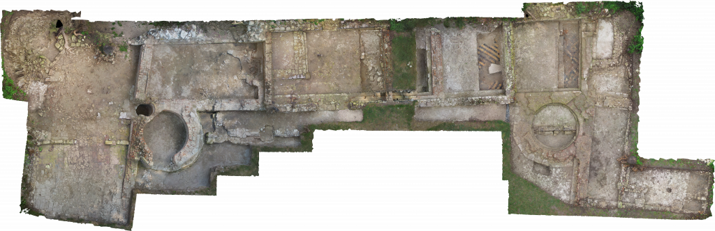
Located in the town of Eaucourt-sur-Somme, this castle’s evolution is tightly linked to the development of the port city nearby, Abeville. With the support of the Departmental Council of the Somme and of the Regional Council of Picardie, a research program has started under the protection of the State. This study’s aim, under the direction of the engineer of study, Sandrine Mouny, is to bring some knowledge about the spatial configuration of this fortified manor house.
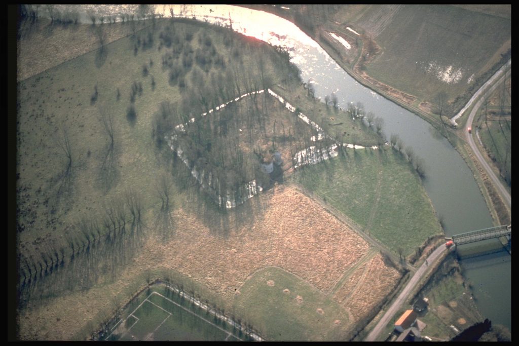
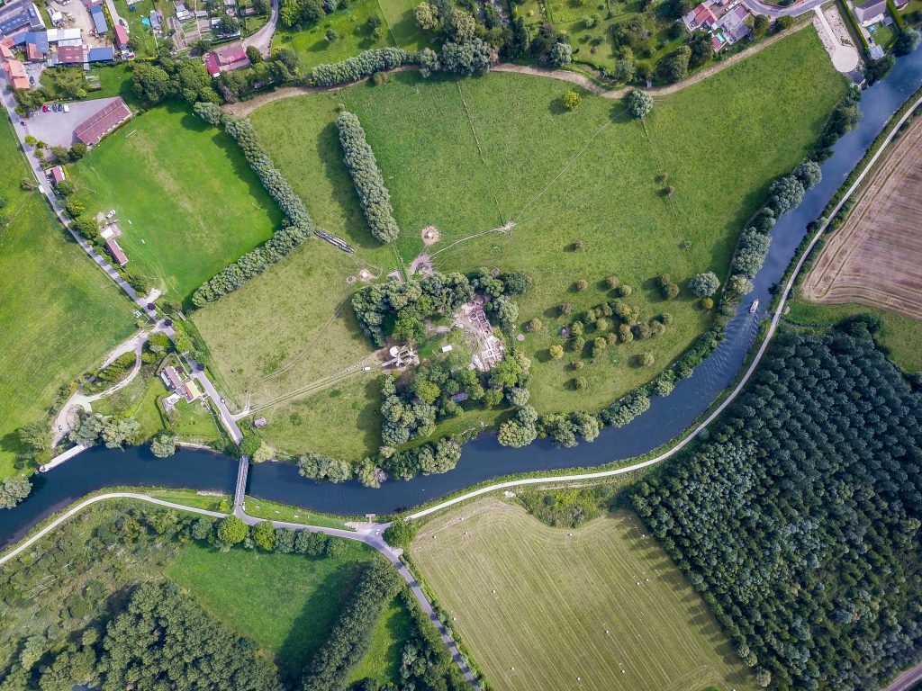
First, the searchers have found some traces of this castle in many documents. According to some written sources, this “domus castri”, was, during the Middle Age, the chief town of a fairly modest rural estate, sharing the land with powerful seigneuries, both ecclesiastical and secular, the castle owners changed very often until the end of the revolution. Then, the first archeological investigations began in 2015 and soon, the searchers have concluded that it was a gothic residence. After some survey, we could clearly distinguish a regular platform topped by a stone enclosure. The whole complex is moated, fed by a canal connected to the Somme. The high courtyard has an avant-garde gatehouse. During the modern era, this residence kept its feudal appearance while being both a courtesy home and eventually, during conflicts, a fortress. One of the main discoveries in the castle was two rooms covered with paving stones in glazed terracotta dating back from the end of the 13th century and the 14th century.
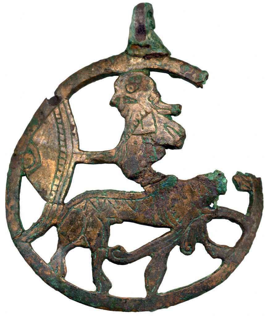
The majority of the furniture found during the excavations show that the castle was mostly inhabited by wealthy and privileged people. Indeed, although some objects were quite ordinary, some others betrayed the well-to-do background of its occupants, like pilgrimage bulbs. Finally, the site was also a touristic area in which tourists could participate to the excavations, reinforcing its attractiveness.
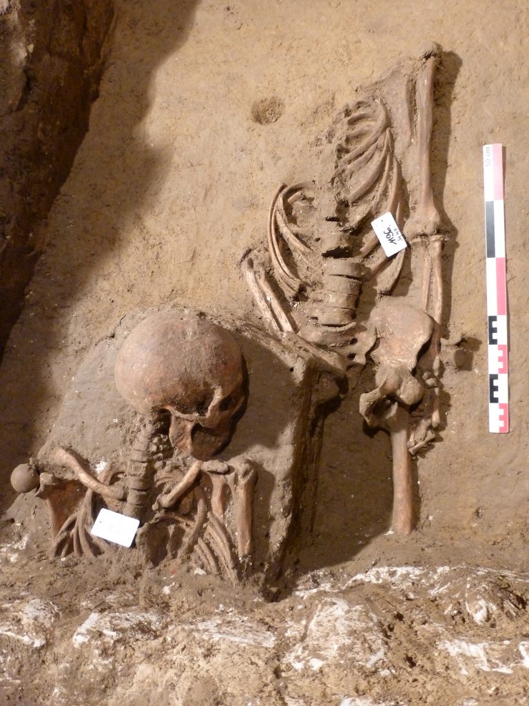
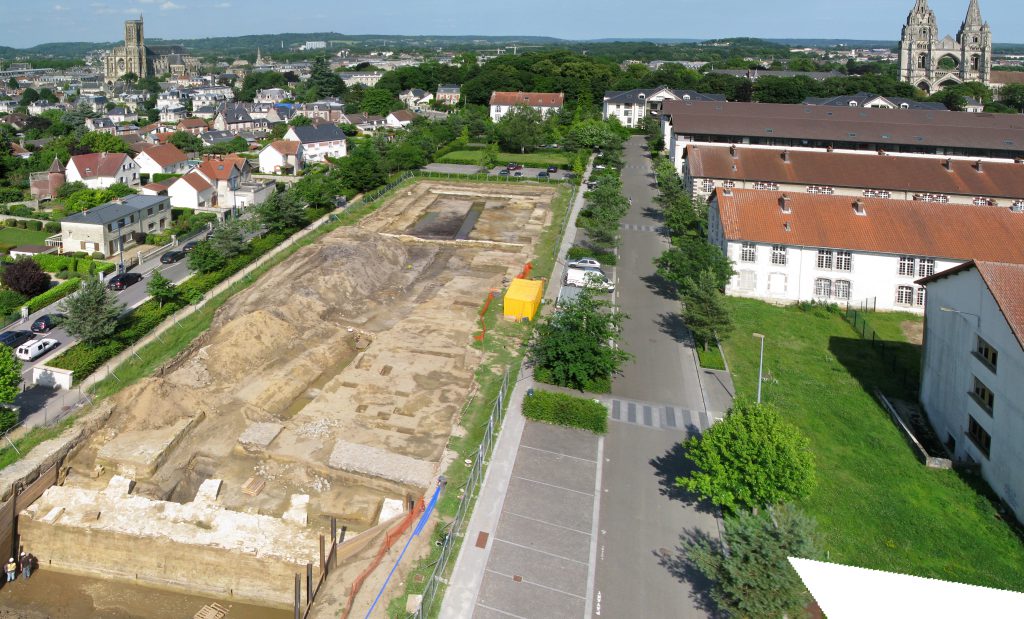
This area which is today a park, was at first a barrack which was designed for the 67th infantry regiment at the beginning of the 20th century. This infantry regiment was dismantled in 1993 and the barracks were included into a rehabilitation project in 2001. Before it had begun, the UPJV has made some preventive excavations on this site, led by Pauline Augé, in 2014. The main goal of those excavations was to study the hornwork of Soissons. However, the antique sepulture of two people was found during the diggings. Their grave must have been moved by the establishment of the hornwork, therefore, they are probably related to the necropolis that was discovered on the hill of St Jean.
In 1617, the siege of Soissons by the Count of Auvergne begins. To defend themselves, several works were established including a hornwork. However, this is a weak defense as it was on the ground. This weakness could also explain why the archeologists struggled to find some traces of this defense. Moreover, the ulterior installations contributed to erase the presence of the hornwork.
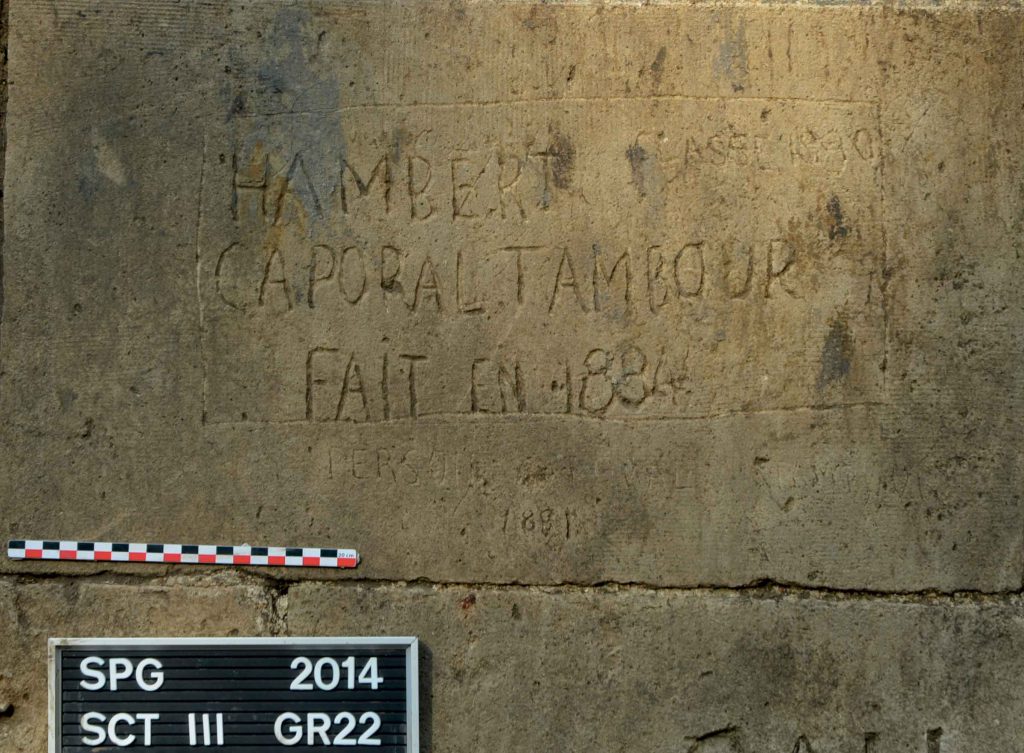
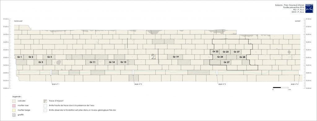
In 1816, some works were undertook to make Soissons a true military stronghold, therefore, in 1825, the idea to create a new hornwork emerges. The objective is to protect Soissons from a possible attack. The documents of this period describe this project with a lot of details about the advancement and the modifications. The project is finally starting in 1843. However, the hornwork’s utility is quickly questioned, as Soissons remains weak to the bombings and Soissons is besieged again. After, that the city tries adopt new defense projects, however, several are abandoned. When the searchers have excavated the remains of the hornwork, they have discovered some graffities.
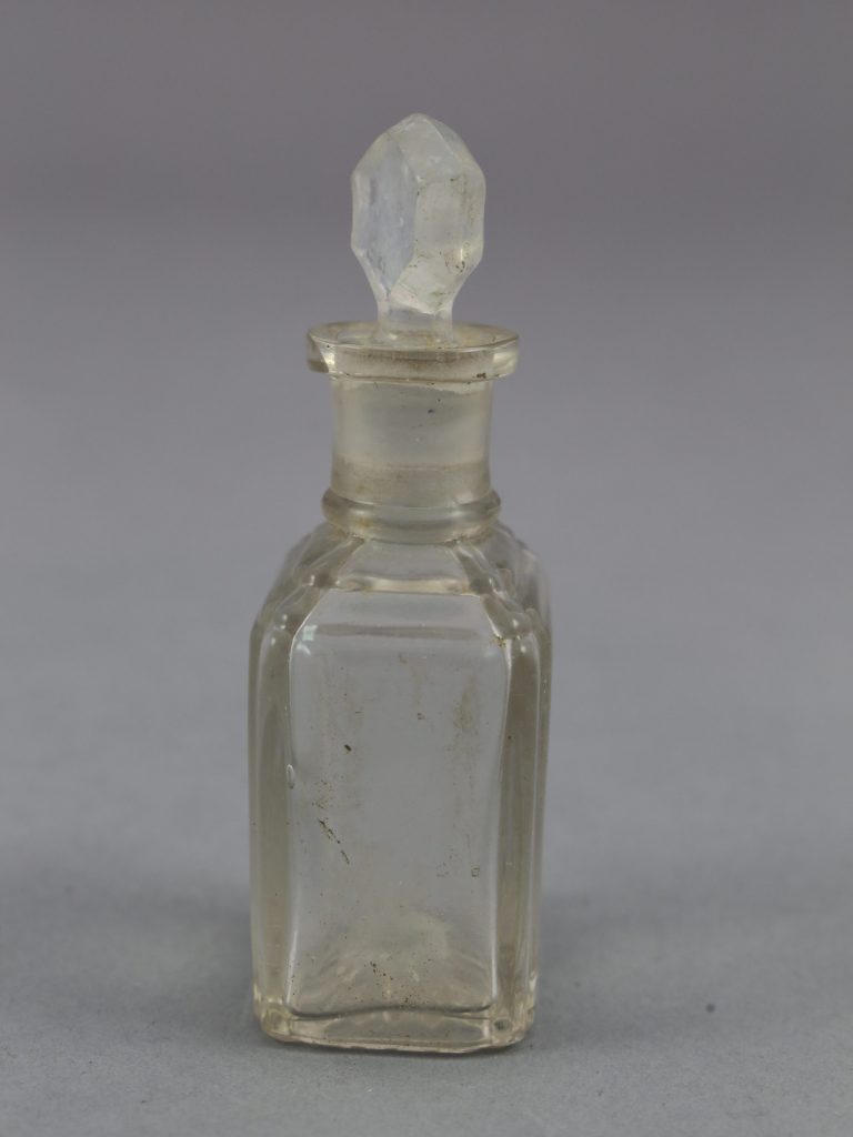
In 1914, a project is proposed: building new barracks for infantries. The project was adopted, lately, in 1916, since Soissons was occupied by the Germans and was near the front. The new barracks were a temporary hospital from 1917 to 1918, forcing the army to find new buildings to settle. During the excavations, a trench probably dating back from 1918, was discovered. It was apparently designed and many objects were found inside. The objects inside are probably dating back from the end of the 19th century and the beginning of the 20th century. Some crockery and glassware were found as well as some everyday objects related to hygiene and health and some objects related to the military lifestyle of the soldiers.
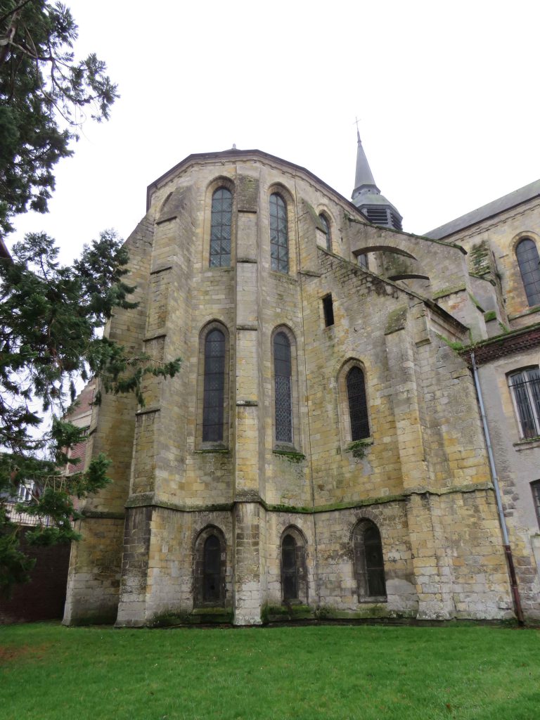
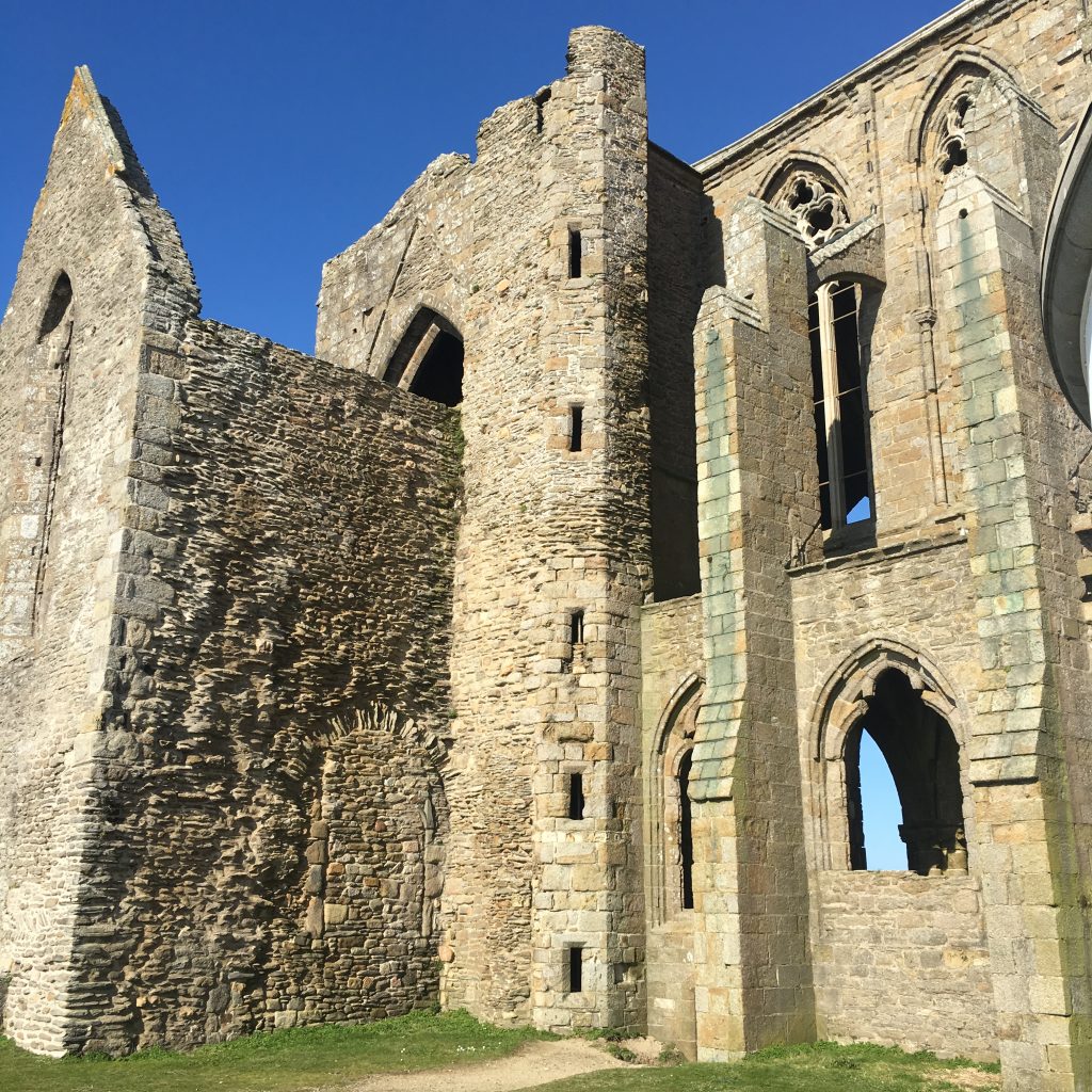
Located in the North of the fortified city, near the door of St Quentin, the church of Ham is one of the last remains of this era and the crypt is an outstanding of the Gothic era. The church dates back from the 12th century; in 1108, it was given by the Lord Odon to the bishop of Noyon. Soon, the church was transformed into an Abbaye and the first monasteries were built. However, the church was burnt to the ground by the Spaniards between the 15th and the 16th century. In the 17th century, the monastery is moved to the south of the church and the decoration of the church is modified. During the French Revolution, the church becomes a barrack and a military hospital. In the 19th century, the church retrieves its religious function and becomes a protected monument in 1888.
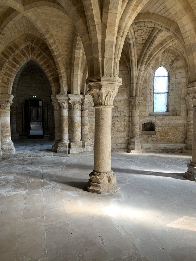
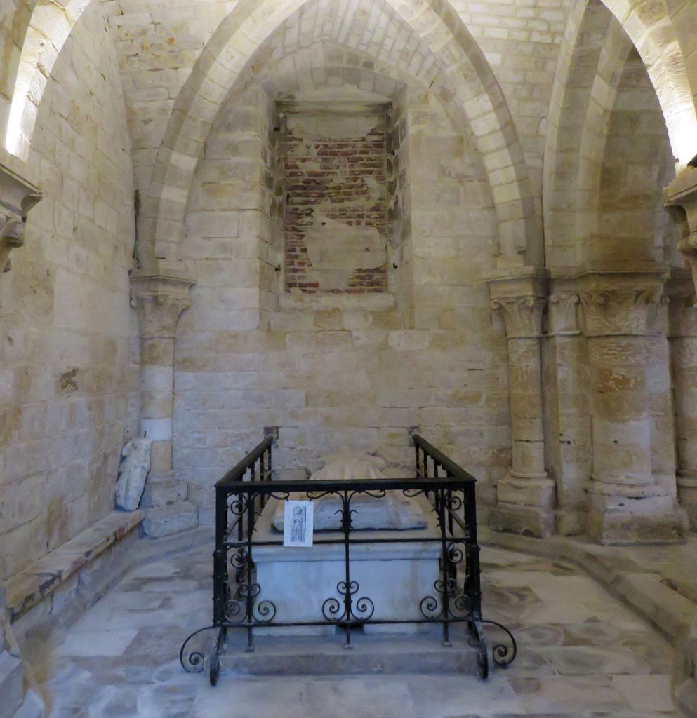
Some parts of the church are dating back from the roman era, especially on the portal area whereas some others, like the core are dating back from the Gothic era. Then, the crypt, located under the core of the church, is characterized by a cross-corridor model. The crypt is semi-buried, taking advantage of the sloping ground. The access of crypt from the exterior is through a door in the north aisle. Present from the time of construction, it is probable that this access allowed communication with the monastic buildings. Initially, the access to the crypt was from inside the church, from the side aisles. Among the outstanding elements found in the crypt, two recumbents’ effigies were discovered in the crypt: Odon IV, the Lord of Ham and his wife, Isabelle de Béthencourt.
One of the goals of the Digital Humanity Platform is to enhance the cultural heritage. Therefore, they have worked on a project of photogrammetry and digital reconstitution which also has a pedagogic goal. Indeed, it includes students from the Victor Hugo middle school of Ham which have had the occasion to assist to some activities. The goal, here, is to make their city’s heritage interesting and to initiate them to the different techniques and methods of survey.
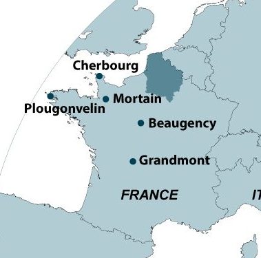
The cities concerned by the virtual reconstitution are Cherbourg and Mortain in Manche and Beaugency in Loiret. Cherbourg’s castle, urban fortifications and village has been reconstituted. For Mortain it is the ancient castle which has been modelized. Here the castles were shown as they were supposed to be before their destruction, as it is described into iconographic and archeologic sources. For Beaugency, the researches were mostly focused on the reconstruction of two living scenes: medieval banquet and dormitory.
The goal of photogrammetry is to have very precise images and at the scale of ruin elevation. With those images, it becomes possible to determine the different stages of construction of the building and to understand its chronology. It was used at first for a project in partnership with the University of Brittany, in Plougonvelin, in Finistère. The searchers had made a photogrammetric survey of the walls of the former Saint-Mathieu de Fine-Terre abbey a photogrammetric survey of the walls of the former Saint-Mathieu de Fine-Terre abbey.
Since 2013, Grandmont’s Abbaye, in Saint-Sylvestre, in Haute-Vienne, is the subject if excavations carried out by a multidisciplinary team directed by the professor Philippe Racinet. The objective of this archeological project is to understand the spatial organization of the abbey, its environment and the life of its occupants.
The archeologic operations have revealed the monastic complex comprising a church and an abbey building with several cellars. There was also a monk’s cemetery which have delivered around 50 sepultures which helped the searchers to understand the funeral practices of the Grandmonters. During the excavations, the archeologists discovered many interesting objects with the sepultures. Indeed, on the top of the thorax of a skeleton, a lead bull belonging to the Pope Clement the 7th , a Pope of Avignon. They also discovered inside graves dating back from the 12th century, around 30 lead flasks with a cross carved on them. Finally, they had also found a censer cover and a small limestone saint statue with traces of polychromy.
UPJV had created an archeological project within a twinning of local authorities between the Department de l’Oise and the Province of Ragusa in the city of Terravecchia located in Sicily and positioned on a volcanic spur. It was an old castle complex which was associated to an important village, destroyed by a violent earth quake.
This site had 3 main assets: a fossilization since the end of the 17th century after its abandonment, diverse archaeological potential (castral, religious and civil buildings and habitats) and abundant historical sources. To understand the origins of this agricultural city, its spatial organization and its material culture, the searchers have made some topographic surveys, targeted surveys but also some documentary researches.
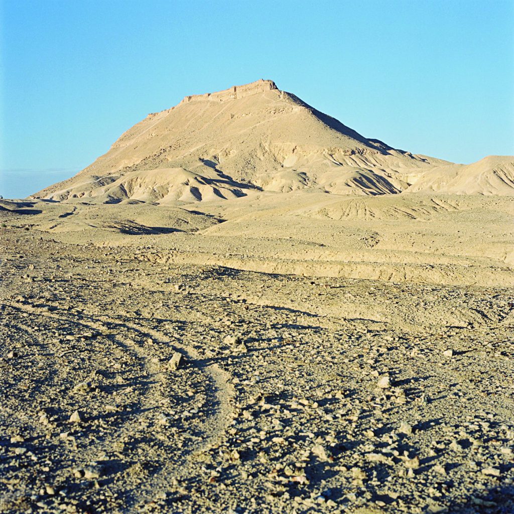
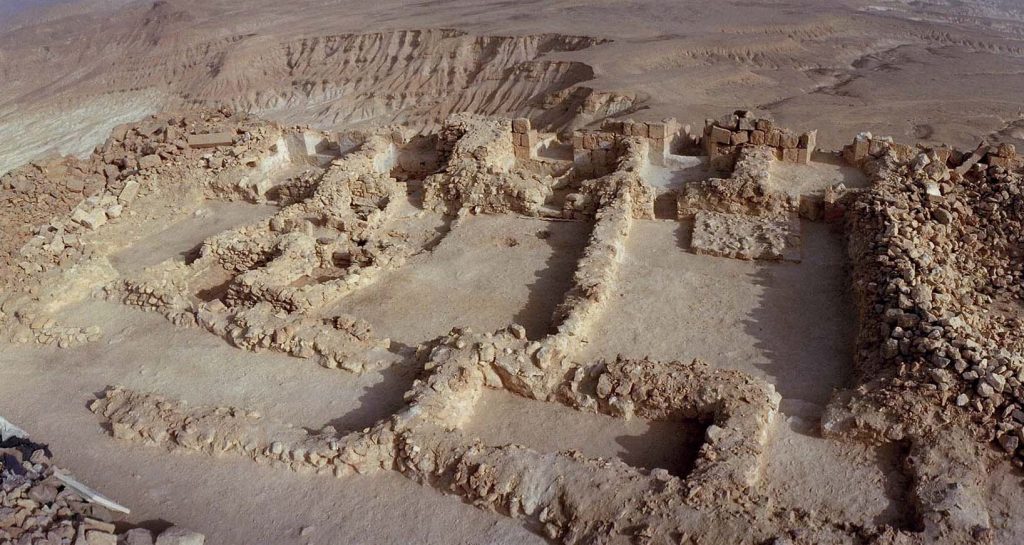
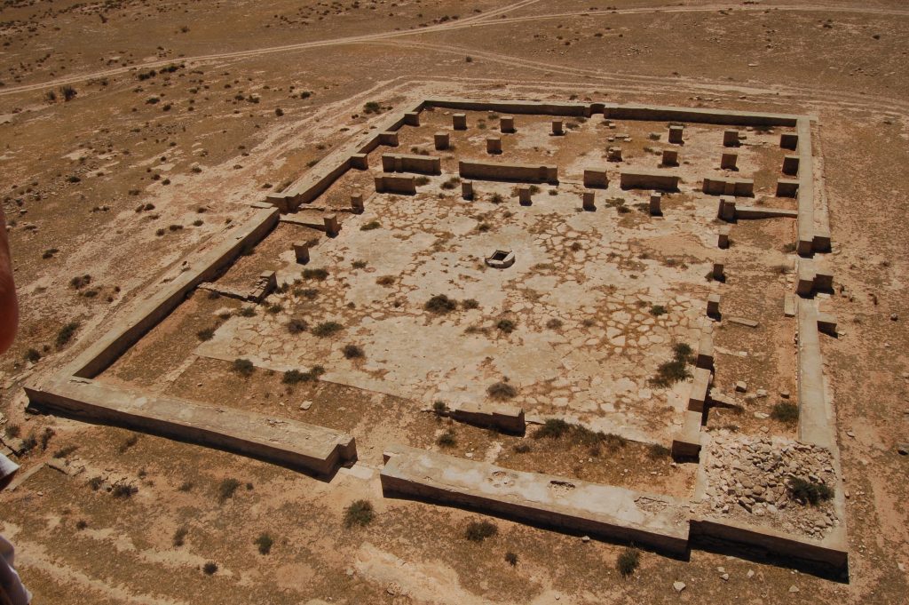
Located on a rocky outcrop which dominate the core of the Sinai desert in Egypt the fortress of Sadr is a unique archeologic site discovered at the beginning of the 20th century by a French engineer, Jules Barthoux. A digging site had been set up there in 2001 under Jean-Michel Mouton’s lead. It was a project between French Institute of Oriental Archaeology and the archeology laboratory of the UPJV.
The archeologist on this project have found some furniture in an exceptional state of preservation. The excavations of the mosque, the governor’s house and of the living units allowed the Scientifics to understand the life conditions of the garrison, the defense organization, the water management in this dry environment and the strong presence of religion.
A French archeologic project took place in the medieval city of Surt, in Libya in cooperation with the Tripoli antiquities department and the Sultan’s office. Although some excavations already happened from 1963 to 2004 and the main monuments had already been found, there weren’t any global study yet. Moreover, the ground and geophysical prospecting and the resumption of excavations and archaeometry studies have revealed the architectural, social and material specificities of the city.
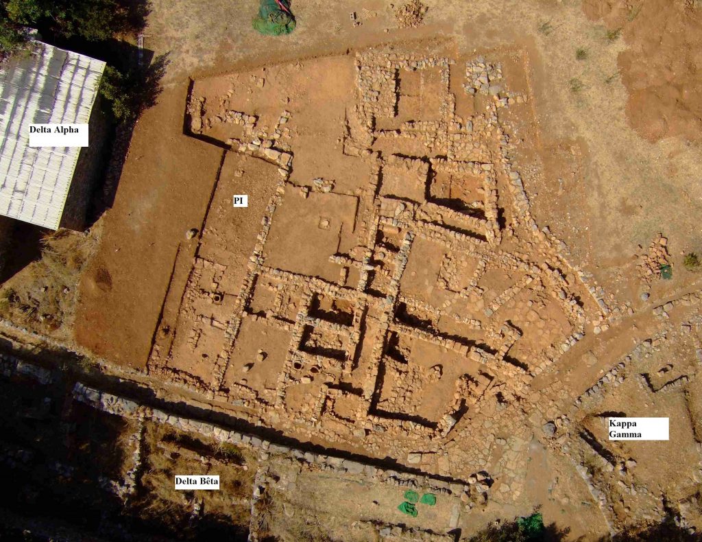
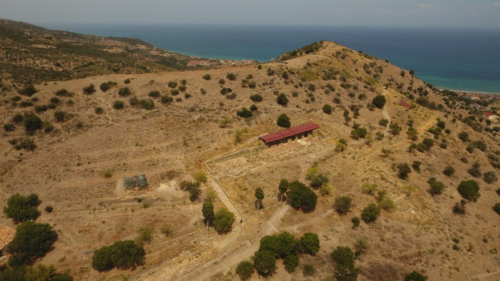
Located on the north coast of Crete, in Greece, this site dating back from Bronze Age has been explored by the French School of Athens since 1917 and was excavated by some students from the UPJV. They explored The Pi Sector. They discovered a large building which has brought some new knowledge about the material culture and the eating and agricultural habits.
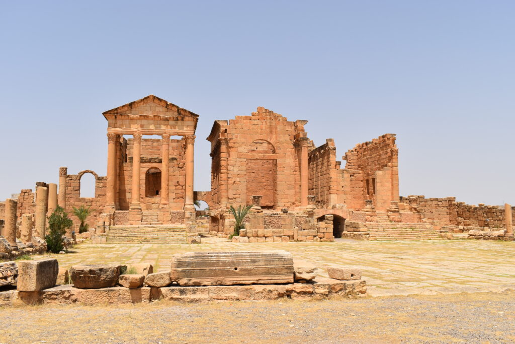
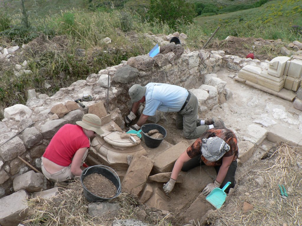
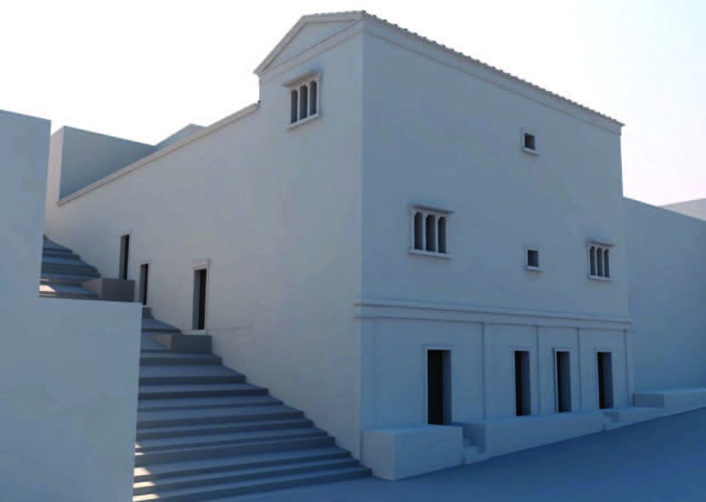
This city, located in Sicily, in Italy, has been studied within an agreement with Italian archaeological and cultural institutions by the UPJV since 2016. The objective of the excavations is the study and enhancement of three sectors of the ancient city of Halaesa: the area of the southern acropolis, the area south of the agora/forum, and the theatre.
First, the southern acropolis was a vast set which is overlooking the city. The several diggings have allowed the searchers to discover a building on the central part of the acropolis. It was divided into 3 main rooms and had to 2 floors. When it collapsed, the stones were probably used again to build a quadrangular building nearby.
The searchers have also found some children graves inside of the building itself dating back from the 6th or 7th century. On the Northern part, a 2-meter cistern was discovered. Then, there were some discoveries is the agora. Agora is the Greek name of the roman forum and is the main public place of the city, surrounded by religious and political building. It can host some assemblies and markets. In Haleasa, the agora/ forum contains an upper and a lower square linked by stairs. At the beginning of the byzantine area, it stops to be the core of the city and becomes a necropolis.
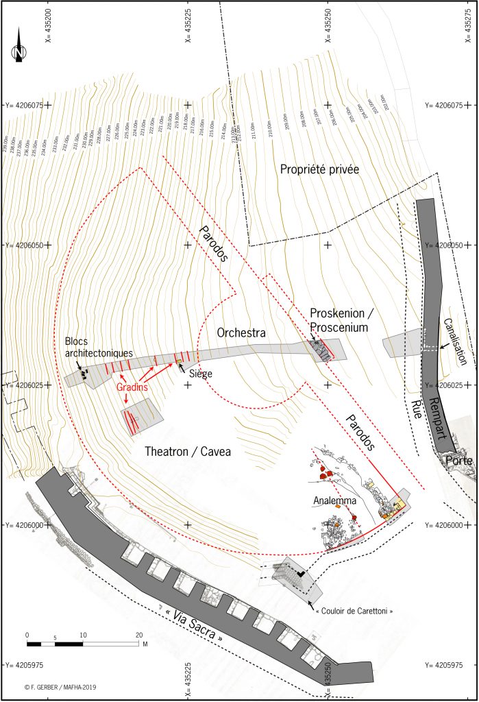
Finally, the theatre is the last studied part of the city. The wide hemicycle in front of the sea and the natural acoustic and luminosity, perfect for theatrical performances, of the place allowed the searchers to understand the presence of the theater. Their hypothesis has been confirmed by the LiDAR (Light Detection and Ranging) and by some electric prospections. The excavations have first shown the bleachers carved into the stone and some decorative elements of the proskenion, the wall of the scene. All of the diggings in this area have emphasized the role of theatre into the everyday life of Haleasa.
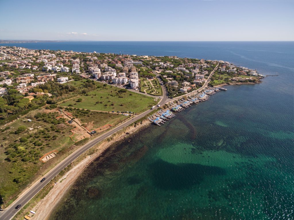
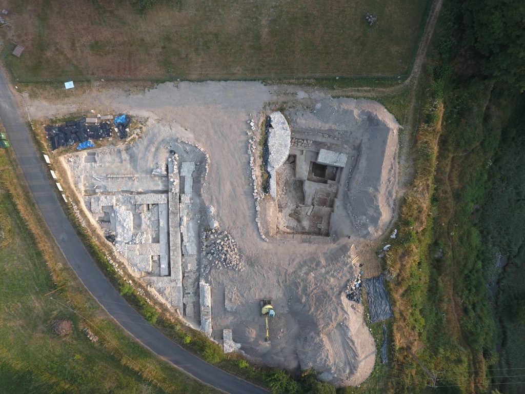
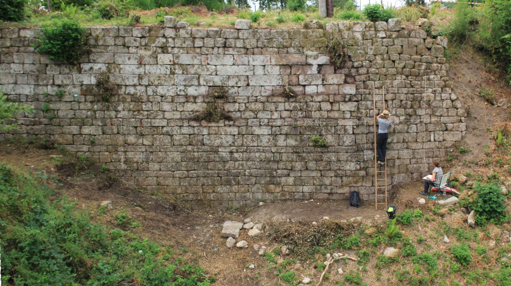
The first excavations into the site of Castrum Novum in Rome, Italy were carried out between 1770 and The 1776 excavations, organized by the Pope Pie VI and the Reveranda Camera Apostolica , were supposed to promote the archeologic sciences, some statues and mosaics were discovered and are now exposed into museum.
The excavations have restarted in 2010 to study the history of the topography of a roman colony whom was founded during the 3rd century B.C. The excavations between 2015 and 2018, have made it possible to find some sections of the wall which was surrounding the colony and which dates back from the first half of the third century B.C. They also found some remains of habitations dating back from its first stage of life and a series of sepultures, located outside of the fortification.
The searchers also tried to find some written sources about Castrum Novum, however, they are quite rare but some of them helped us to discover the configuration of the city and its buildings such as a theater, and some banquet rooms. Castrum Novum was also a port city and had some buildings in relation with this small port. Indeed, there was a tavern and a small balneum designed to welcome travelers. Finally, many objects to put in relation with a sea economy were discovered. Indeed, some fishing net weighs were found prove that many inhabitants were living from fishing. They were also living from fish-farming; Both activies made it possible for the colony to have an economy based on the sea products, intending for small-scale local consumption.